|
|
![]()
The City of OrangeburgClick on the thumbnails for a larger image. |
|

|
Orangeburgh 1735This is a composit map with the Orangeburgh 1735 town plan overlying a modern topographic map. Amelia, Broughton, and Windsor Streets were used to align the town plan to the modern map. Also included are locations for some of the original land grants along the Edisto River -- including that of Heinrich Rickenbacher. The grants were mapped from the original plats. |

|
Orangeburg 1891This map was published in the Times & Democrat on May 30, 1965. It shows that Orangeburg was still a very small town in 1891 with little development north of Amelia Street or south of Glover Street. |
![]()
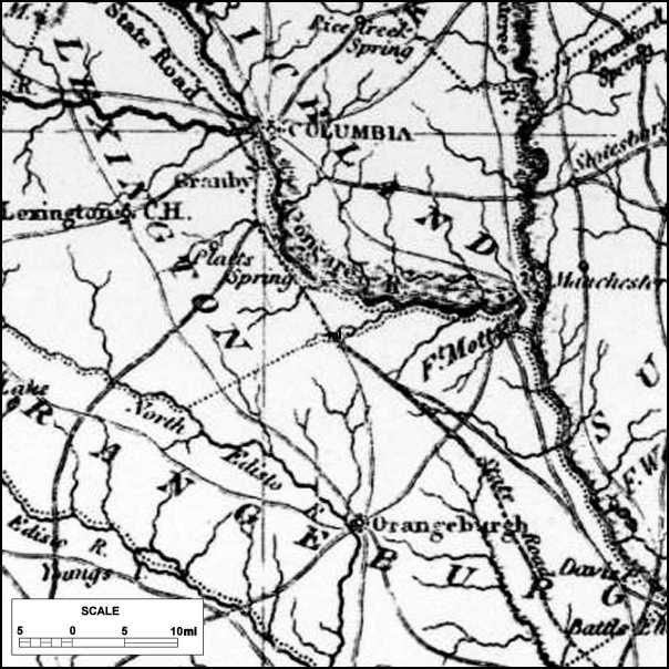
The Orangeburg AreaThese maps all cover approximately the same area -- the original parishes of Amelia, Orangeburg, and Saxe Gotha. In modern terms, they extend from Cayce/Columbia in the north to just below Rowesville in the south. Click on the thumbnails for a larger image. |
|

|
De Brahm 1757A Map of South Carolina and a Part of GeorgiaThe original map is composed of 4 sheets, each 24 x 26 1/2. The scale is about 1" = 5 miles. This small segment of the northwest sheet shows the Amelia, Orangeburgh and Saxe Gotha Parishs. A portion of St. George Parish is at the botom in green and a corner of Fredericksburg Parish is at the top in red. Click on the thumbnail to see this map segment at approximately half scale. The complete map may be viewed at the Historical Maps Archive of The University of Alabama. |

|
Mouzon 1775An Accurate Map of North and South Carolina With Their Indian FrontiersThe original map is composed of 4 sheets, each 28 1/4 x 19 7/8. The scale is about 1" = 8 2/3 miles. The most commonly used map of North and South Carolina during the Revolutionary War. Click on the thumbnail to see this map segment at approximately two-thirds scale. |
|
Mills 1825Atlas of the State of South CarolinaThis is a segment from the Mills Atlas map of South Carolina. This map is a reduced version of Wilson's State Map of 1821. |

|
USGS 1999This is a modern topographic map of the Orangeburg area. This image was prepared using Delorme 3D TopoQuad software. Topographic maps may be accessed online at TopoZone.com. |
![]()
| Genealogy Home | Rembert Family | Rickenbacker Family | Links |
Copyright © 2002, 2004 by J. E. Rickenbacker. All rights reserved.
1-27-07